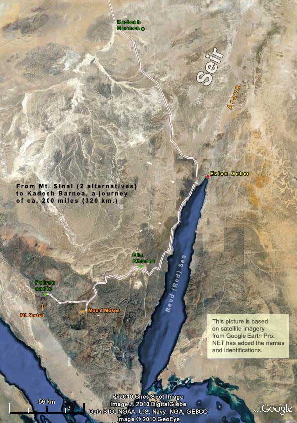
Where was Mount Sinai?
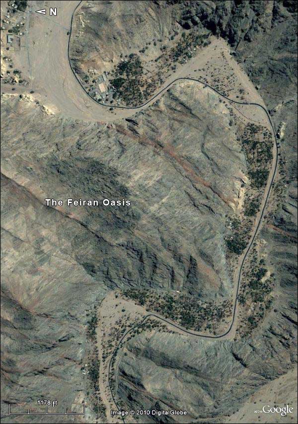 |
| The Feiran Oasis |
On this route is the oasis of Feiran, the largest in south Sinai, with a palm grove six miles long. It is popularly identified as Rephidim, where Moses, at Yahweh’s command, procured water by striking a rock. (If the identification is correct, then the story would have served to explain the existence of this wonderful oasis.) One detail is of special interest. In Exodus 17:4-5, Moses cries out that the people are ready to stone him. Then Yahweh says,
Pass before the people, and take the elders of Israel with you. And the rod that you smote the Nile with, take it with you and go. Behold, I shall stand before you there on the rock, in Horeb, and you shall strike the rock and water will come out.
Now, Horeb is a frequent alternative name for Mt. Sinai. It seems from this passage that Moses and the elders depart from the people, from Rephidim, but not very far, to Horeb. Suppose that the Feinan oasis is Rephidim. There is a grand mountain whose north edge is two miles from Feinan, and various scholars have identified it as Horeb-Sinai. This is Mount Serbal. Here is the relationship:
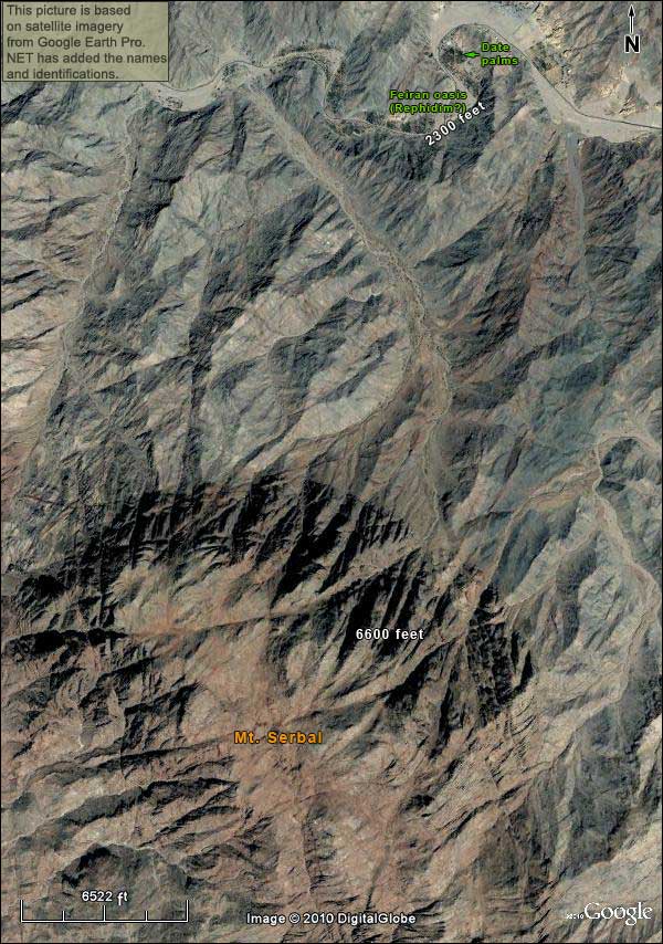
A problem with this location for Mt. Sinai is that the nearest broad plain where the Israelites might gather is the Feiran oasis itself. To some this seems rather far for shuttling between Yahweh and the people, as Moses did. At the traditional location, Mount Moses, there is a broad plain. So if we are picturing 600,000 men plus women and children gathered below (Exodus 12:37), we should prefer Mount Moses:
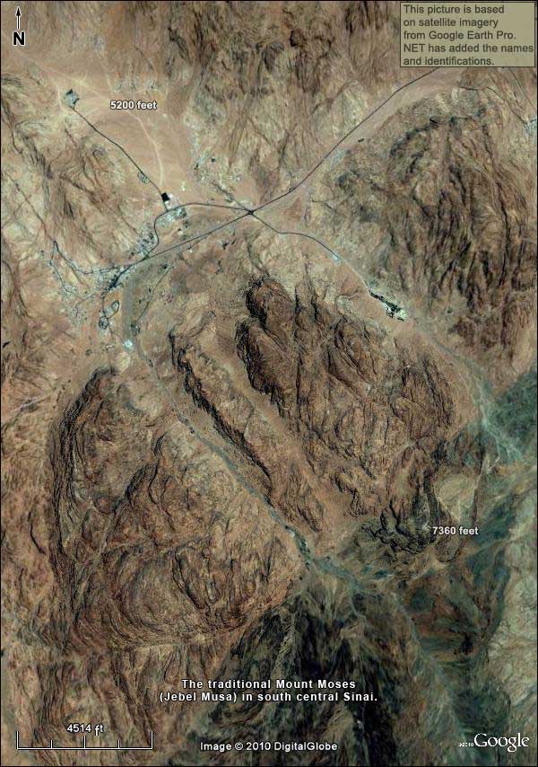
Exodus has the Israelites staying for an extended time in Rephidim: here the battle with Amalek occurs, and the visit of Jethro is placed at this point in the narrative. Then they set out, enter the Wilderness of Sinai, and encamp before “the mountain” (Exodus 19:1).
Do we have any other hints as to the location of Mt. Sinai? Deut. 1:2 is helpful:
It is eleven days from Horeb, by the way of Mount Seir, to Kadesh Barnea.
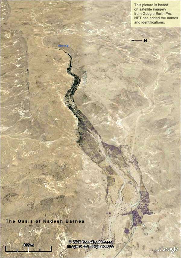 |
| The oasis at Kadesh Barnea |
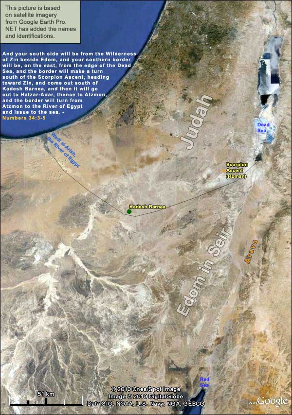
The Bible gives us indicators for locating Kadesh Barnea, namely the descriptions of Judah’s southern border in Numbers 34 and Joshua15:3. Here is Numbers34: 3-5 —
And your south side will be from the Wilderness of Zin beside Edom, and your southern border will be, on the east, from the edge of the Dead Sea, and the border will make a turn south of the Scorpion Ascent, heading toward Zin, and come out south of Kadesh Barnea, and then it will go out to Hatzar-Adar, thence to Atzmon, and the border will turn from Atzmon to the River of Egypt and issue to the sea.
Joshua 15:3 is similar. Both passages place Kadesh between the estuary of the “brook of Egypt” (Wadi al-Arish) and the southern tip of the Dead Sea. Such a place between the two is the area of ‘Ain el-Qudeirat, a spring that produces about 40 cubic meters per hour, creating the largest oasis in northern Sinai. There is nothing at all like it between Wadi al-Arish and the Dead Sea. The site was almost certainly Kadesh Barnea.
We cannot locate all the places in Numbers 34: 3-5, but we do know Wadi al-Arish and Kadesh. The Scorpion Ascent, as the first point mentioned west of the Dead Sea’s southern tip, was probably close to the place of the same name in the Roman period. With that much, we can draw the border like this (we shall later discuss the location of Edom west of the Arava):
Returning to Deut. 1:2, note the inclusion of Mount Seir: “It is eleven days from Horeb, by the way of Mount Seir, to Kadesh Barnea.” As said in the previous section, Bible maps often put Seir east of the Arava, because it is associated with Edom, which settled on the east, south of Wadi Hasa (the Biblical Zered). But the Edomites did not become sedentary until the 9th century BC at the earliest.
We have no way to pinpoint Horeb-Sinai. Both alternatives given above – Mt. Moses and Mt. Serbal – fit the measurement of eleven days to Kadesh. Using the course of the modern roads to the north shore of the Red Sea (which follow a topography that has probably not changed much in 4200 years), and then taking the road from there to Kadesh, which skirts the southern edge of Seir, we measure a total of about 200 miles. In eleven days, that would work out to eighteen miles a day, which is conceivable.
